 |
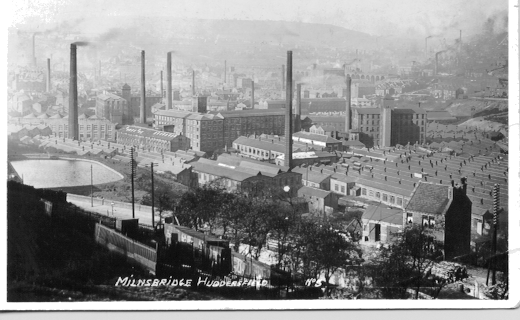
View of Milnsbridge
looking from Briefly Wood towards Golcar
Photograph taken about 1930, depicts the scene and atmosphere of that time, with the
numerous textile mills working in full capacity. Milnsbridge was one of the most
important places for many textile companies, the river Colne rang through it's centre and
supplied the water. |
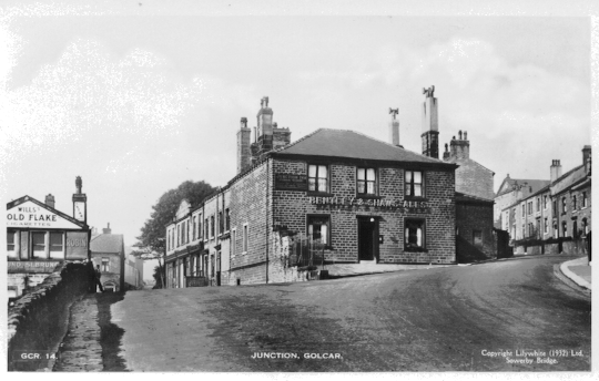 |
Junction of Scar Lane,
Knowl Bank on the right and James Street on the left.
A 1930's photograph of Golcar looking towards the Junction Inn, situate at
the top of Scar Lane. In the distance on the left can be seen the Knoll Road
Methodist Church and on the left a collection of shops, which included a butchers, and one
of Golcar's co-operative stores. |
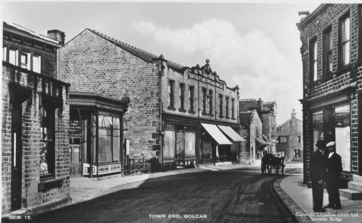 |
Town End Golcar taken
about 1930.
Considered as possibly the centre of the village, this area housed many shops, the large
building with the canopies is the Golcar C-operative society and the surrounding buildings
are it's associate, bakers, butchers and boot repairing shops. |
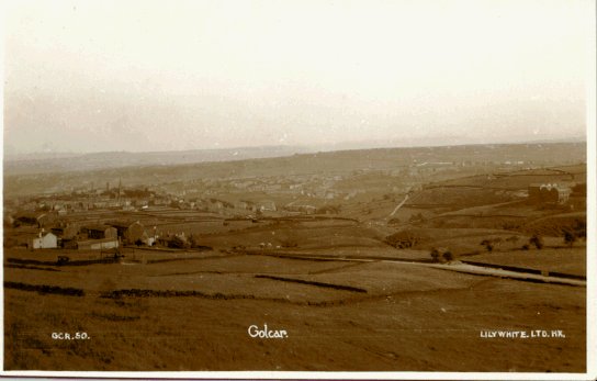 |
View of Golcar taken from
Scapegoat Hill 1930's.
This depicts the panoramic views which are available from Golcar's highest point,
Scapegoat Hill, just at the front of the picture is Bolster Moor, in the distance the
village of Linthwaite. |
 |
View of Golcar taken from
Wellhouse looking towards Carr Top 1930's.
Panoramic view looking across to Golcar, showing Brook Lane at the foot rising up the
hillside towards Carr Top, Handel Street, Bunkers Hill, Church Street. The hamlet in
the bottom left corner is New York Bottom. |
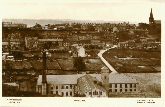 |
View of Golcar looking
towards Victoria Road, and the Ridings, 1930's.
At the foot of the picture is the Victoria Mill or Golcar Mill as it is known locally,
behind rises Victoria Street which leads to the Ridings on the left and further up towards
Town End where you can just see Golcar Church in the top right corner. |
 |
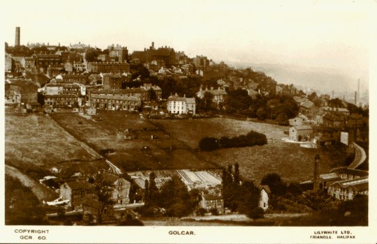
View of Golcar taken from
Bolster Moor 1930's.
Another panoramic view looking down towards Golcar, this shows examples of the different
occupations, from farming on the hill sides to the giant textile mills in the valley
bottom to the many weavers cottages clustered in the centre of Golcar. |
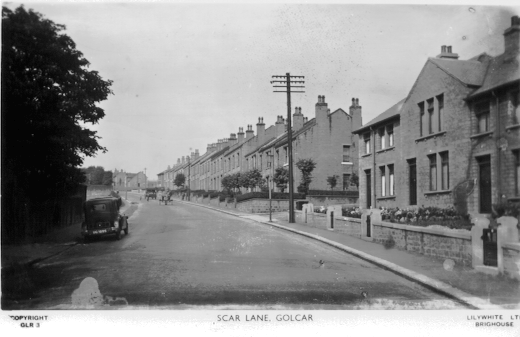 |
Scar Lane Golcar, taken
from Rufford Road in the 1930's.
As the textile industry expanded so did the population, these houses being built in the
early 20th century and possibly occupied by the mill workers, Scar Lane overlooks the
Colne valley and the textile mills in the valley bottom and it is not surprising to find
many large victorian mansions situate here. |
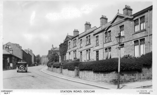 |
Station Road, Golcar taken
in the 1930's.
A early picture showing a motor vehicle travelling up Station Road, previously transport
had been provided by carriers who employed the use of horse drawn vehicles. Myrtle
Row on the left built in the 1900's by the Golcar Co-operative society. |
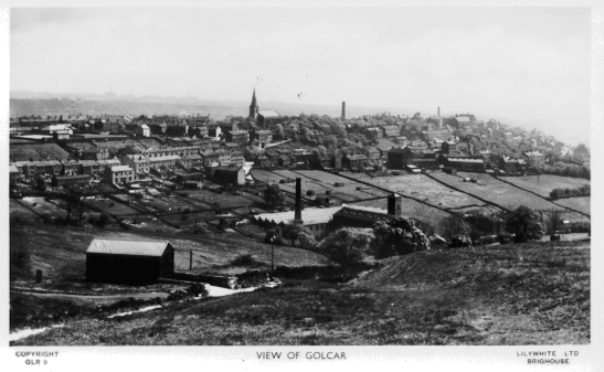 |
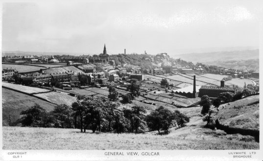
View of Golcar taken from
Bolster Moor 1930's.
Another panoramic view of Golcar looking across towards the Ridings on the left, Golcar
Church's spire can be seen in the centre, a splendid photograph depicting the hill side
village of weavers cottages. |
